
São Miguel is the largest and most populated island of the Azores, and the principal entry point is Aeroporto Internacional João Paulo II in Ponta Delgada. With a total area of 759.41 km2, São Miguel is 65 km long (E-W) and 14 km wide (N-S). The island features some of the best hiking possibilities in the Azores. Here are some of the more popular ones, although there are certainly many others!
Scenic Hikes in São Miguel
1) Moinho do Felix trail - Cascada da Gruta (TM06)
Distance: 5.5 km (3.4 mi)
Type: loop (or out-and-back if you only hike a part of it)
Difficulty: Medium
Time: 2 hours
Parking: roadside in Lomba de Sao Pedro
Moinho do Felix offers a hike that will feature not only amazing nature along the trail but the benefit of not many people. It is one of the lesser known trails on the island.
The official start of this circular route is at the Church of Sao Pedro in the village of Lomba de Sao Pedro. A large part of the trail goes through farmlands. If you are short on time or energy, you might consider skipping that part and only hike the eastern part of the trail, which takes you into a serene forest with ancient trees and aromatic flowers.
The trail is should be considered medium difficulty due to its steepness and many stairs but it’s well worth the effort.
In the forest, you’ll find the ruins of an old water mill and three different waterfalls – Cascata da Gruta, Cascata do Teofilo and Cascata do Homem. Many consider the Cascata da Gruta (Cave Waterfall) to be one of the most beautiful waterfalls in the Azores. If it is summer, be sure to bring your swimwear to take a dip at these waterfalls.
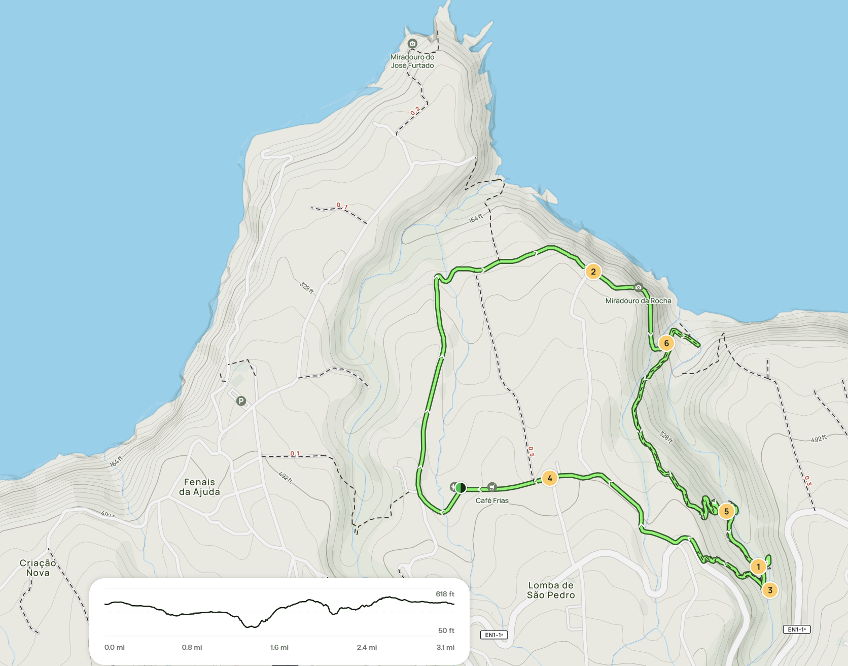
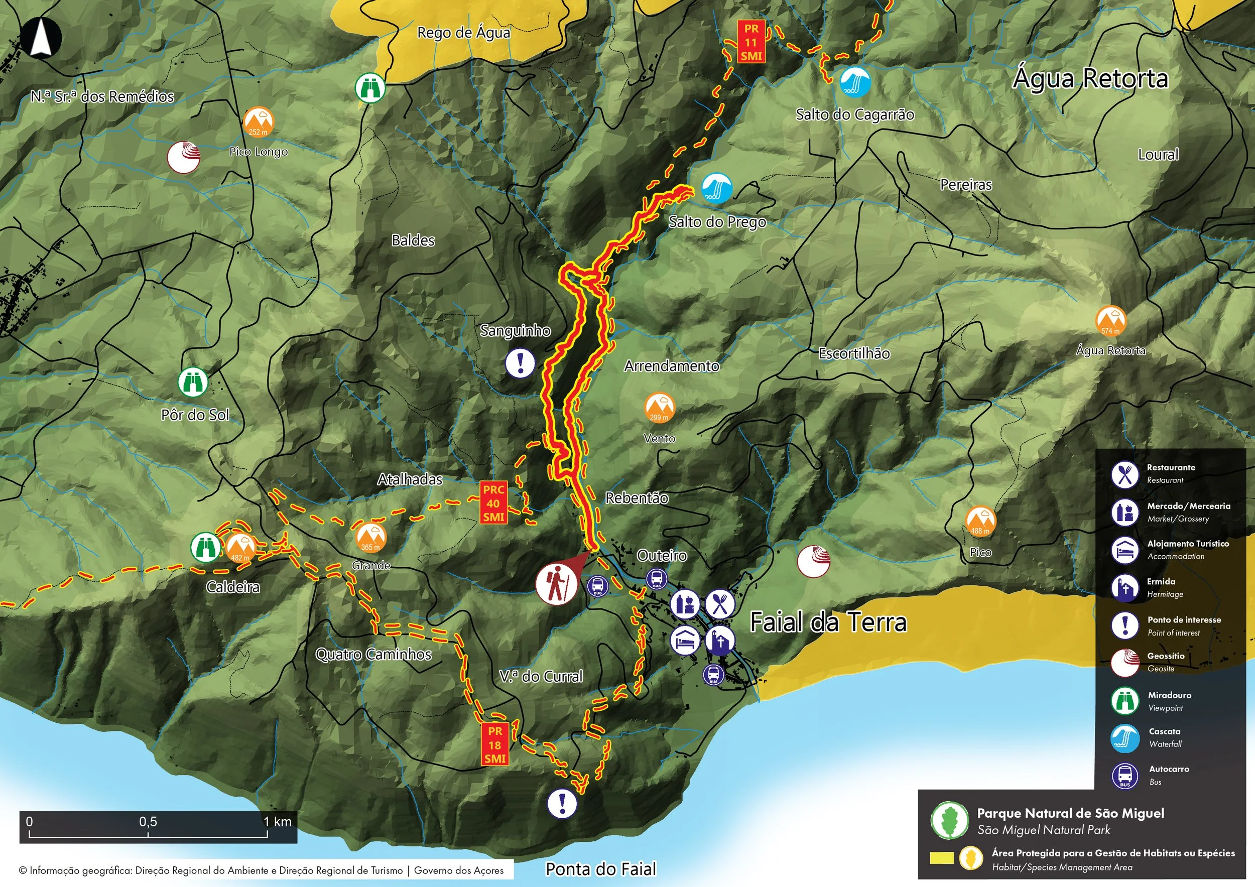
2) Salto Do Prego waterfall hike “Sanguinho” (PRC 09 SMI)
Distance: 4.6 km (2.9 mi)
Type: loop
Duration: Around 2 hours
Difficulty: Easy
Parking: roadside in Faial da Terra
This hike is a bit out of the way, which also means that there are few people. The trail is officially designated as PRC09 SMI trail, also known as the Sanguinho trail, and it begins in the village of Faial da Terra, on Rua Burguete.
The trail follows a small stream at the bottom of a valley and takes you through a lush forest full of chirping birds and colorful flowers. For some reason, there were also a lot of chickens on the trail when we hiked it. The trail can be muddy and slippery if it has rained recently.
After about 40 minutes of hiking, you’ll arrive at the glorious Salto do Prego waterfall surrounded by abundant greenery. At the base of the waterfall, there’s a nice plunge pool perfect for cooling off. If you want to see another waterfall – Salto do Cagarrão – continue hiking past Salto do Prego. This will add 4 km (2.5 mi) to the total distance of the hike.
On the way back, make sure to do a small detour to the abandoned village of Sanguinho. There’s a point where the trail splits, with a sign pointing towards the village so it’s impossible to miss it.
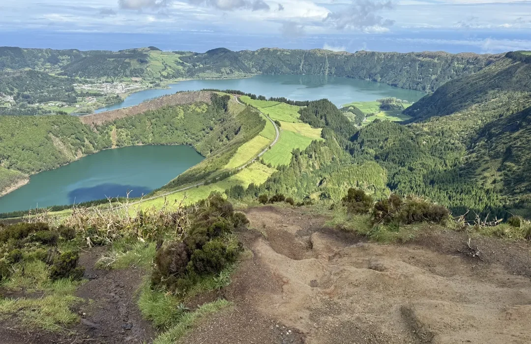
3) Vista do Rei, Sete Cidades (PRC03 SMI)
Sete Cidades is an area of stunning and breathtaking natural beauty located on the western side of São Miguel. It’s one of the most popular and frequently visited places on the island and is especially famous for its massive, lush green caldera that houses two beautiful twin lakes inside. Visitors can explore several different hiking trails in Sete Cidades, each offering unique views and experiences; here are four of the most enjoyable hikes to try.
Distance: 7.5 km (4.7 mi)
Type: point-to-point
Difficulty: Easy
Time: 2 hours
Parking: Vista do Rei parking lot or the lot called ‘Longterm parking’ (see the location on the map).
This trail starts at the Vista do Rei viewpoint, one of the best viewpoints in Sete Cidades. The volcanic crater of Sete Cidades is the most famous landmark on São Miguel. The Vista doRei viewpoint offers an amazing panorama of the two biggest lakes in the area – Lagoa Azul and Lagoa Verde (Blue Lake and Green Lake). This view is definitely one of the highlights of any trip to the Azores.
From the viewpoint, the PR03SMI trail follows the western ridge of the caldera and ends inside the Sete Cidades village.
To get back to the starting point of the hike, you can take a taxi from the village or you can hike back along the shorter but steep path parallel to the west shore of Lagoa Verde. This would add 3.7 km (2.3 mi) to the total distance.
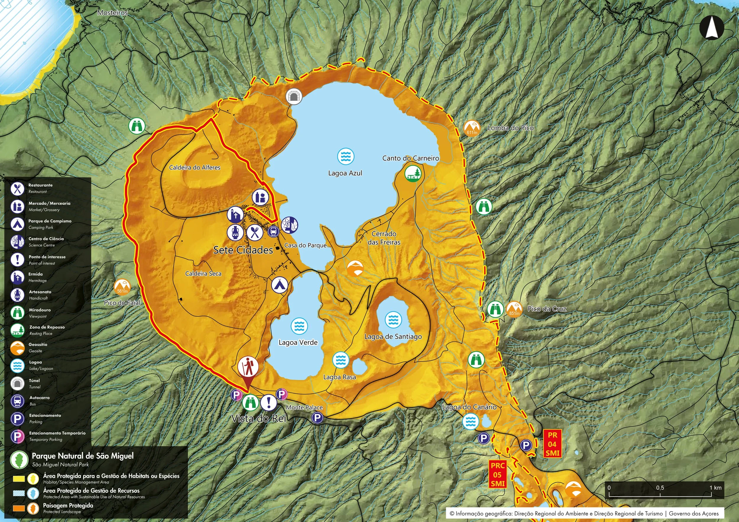
PRC03 SMI trail, highlighted in red
4) Sete Cidades Caldera Rim
Distance: 20 km (12.4 mi)
Type: loop
Difficulty: Medium
Time: 6 hours
Parking: Lagoa do Canário parking lot, Vista do Rei parking lot or the lot called ‘Longterm parking’ (find the location of it on the map at the end of this post)
If you are looking for along hike, then the Sete Cidades hike is a good option. This trail goes around the entire rim of the caldera, instead of descending to the Sete Cidades village at the bottom of the caldera.
Tip: Pay attention to the weather. The Sete Cidades area is often covered with low clouds. It is a good idea to check the Spot Azores app before heading out to explore this area. The app offers a live view of different parts of the island, which gives you an idea of what the visibility is like and whether you’ll actually be able to see any of the views.
Boca do Inferno Viewpoint, Sete Cidades
5) Mata do Canário to Sete Cidades (PR 04 SMI)
Category - Linear
Difficulty - Medium
Extension - 11.8 km
Time average - 3h00
The official PR04 SMI trail begins at the Mata do Canário parking lot. You’ll be walking mostly on a dirt road, which follows the ridge of the Sete Cidades caldera. If the weather cooperates, you will have breathtaking views of the giant caldera with its green walls and bright blue lakes.
It makes a half circle around the caldera before descending to the village of Sete Cidades below. There you can have lunch in one of the local restaurants, take a dip in the lake, and rent kayaks or SUPs to explore the lake.
Since the hike finishes in a different place than it starts, you’ll have to take a taxi back to the starting point. Or you could hike back the same way but that would turn it into a very long and exhausting hike.
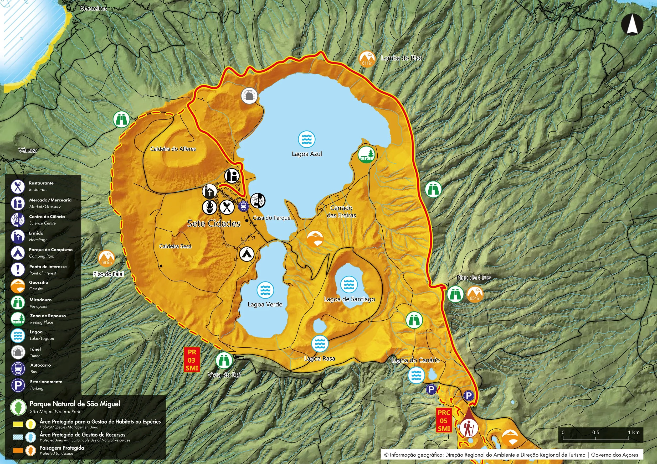
PR04 SMI Trail, highlighted in red.
6) Salto do Rosal hike
Distance: 5 km (3.1 mi)
Type: out-and-back
Difficulty: Easy
Time: 1.5 hours
Parking: Parking lot near the southeast shore of Furnas Lake
Discover a charming trail that leads to the beautiful waterfall of Salto do Rosal, located in the lush Jardim José do Canto, close to Lagoa das Furnas. There is an entrance fee of €4 (cash only). The park has several walking trails and gorgeous lush nature, including tree ferns and towering sequoia trees.
The trail to Salto do Rosal waterfall winds its way through a tranquil Japanese cedar forest and jungle-like vegetation. The trail is flat the whole way and easy to follow but it can get muddy after it has rained.
In about 30 minutes, you’ll arrive at the enchanting Salto do Rosal waterfall, hidden in a small green canyon. Although the waterfall is quite small, it’s surroundings make for a pleasant time.
7) Praia Lagoa do Fogo (PR02 SMI)
Distance: 11 km
Type: Circular
Difficulty: Medium
Time: 4h00
Parking: Parking lot near the southeast shore of Furnas Lake

8) Lagoa do Fogo hike
Distance: 4 km (2.5 mi)
Type: out-and-back
Difficulty: Medium
Time: 1.5-2 hours
Parking: Miradouro da Lagoa do Fogo parking lot
This short hike takes you to the mountainous region in the central part of Sao Miguel and offers spectacular views of the crater lake known as Lagoa do Fogo (Lagoon of Fire). The trail starts at Lagoa do Fogo viewpoint (Miradouro), where it descends to the beautiful blue-green lake. This section of the trail is quite steep and somewhat slippery so be sure to wear comfortable shoes.
Down at the lake, you can walk along its shores, enjoy the tranquility of this place and take in the views of the green mountains surrounding you in every direction. Be aware that swimming is not allowed in Lagoa do Fogo since it’s a nature reserve.
If you’re doing the hike between June 15th and September 30th, be sure to arrive at the parking lot at the beginning of the trail before 9 am. This is because the road leading there is closed for rental cars between 9 am and 7 pm. Within those hours you can only go up there with a tourist shuttle, which is a less convenient option.
*Note: Parts of this Lagoa do Fogo trail may be closed when the water level of the lake gets too high. During these periods, you can usually still hike from the viewpoint down to the lake but not along the shores of the lake.
Tips:
– Use the Spot Azores app before going to Lagoa do Fogo to see the weather conditions since this area is often covered with clouds.
– Another nearby trail worth exploring is the one starting at the large antennas at Pico da Barrosa and continuing southeast along a mountain ridge. It’s not a very clearly defined trail but it offers a great view of Lagoa do Fogo and there are usually few people.
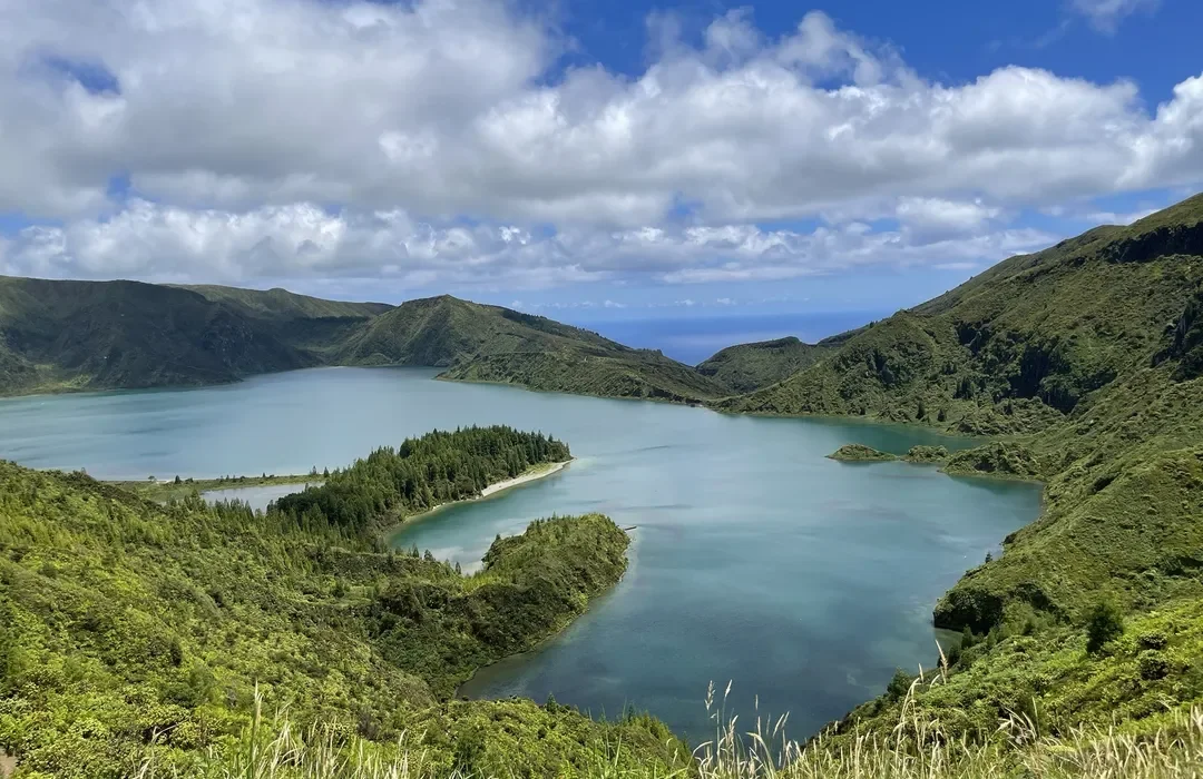

Lagoa do Fogo Miradouro (Viewpoint)
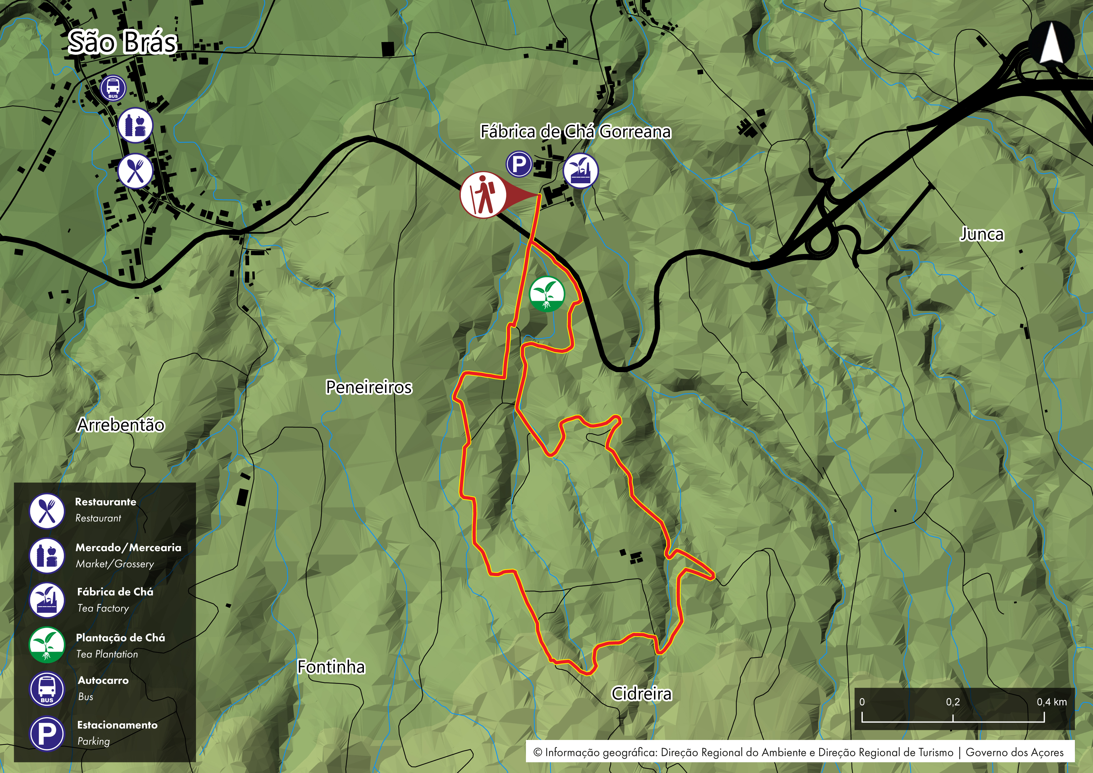
9) Chá Gorreana/ Gorreana Tea Plantation (PRC28 SMI)
Distance: 3.4 km (2.1 mi)
Type: loop
Difficulty: Easy
Time: 1.75 hours
Parking: Gorreana Tea Factory parking lot
This is a circular route which leads you through Europe’s largest and oldest tea plantation, dating to 1883 – Chá Gorreana. The starting and ending point of the hike is Gorreana Tea Factory, where you can learn about tea production and taste the local tea.
From there, the trail takes you into the bright green tea fields spread across rolling hills. The landscape here is really picturesque and looks more like something you’d find in Asia rather than in Europe. From the higher parts of the trail, you can also see the Atlantic Ocean in the background.
As the Gorreana Tea Plantation trail is flat and well-maintained, it’s a great option for those looking for easy hikes in São Miguel.
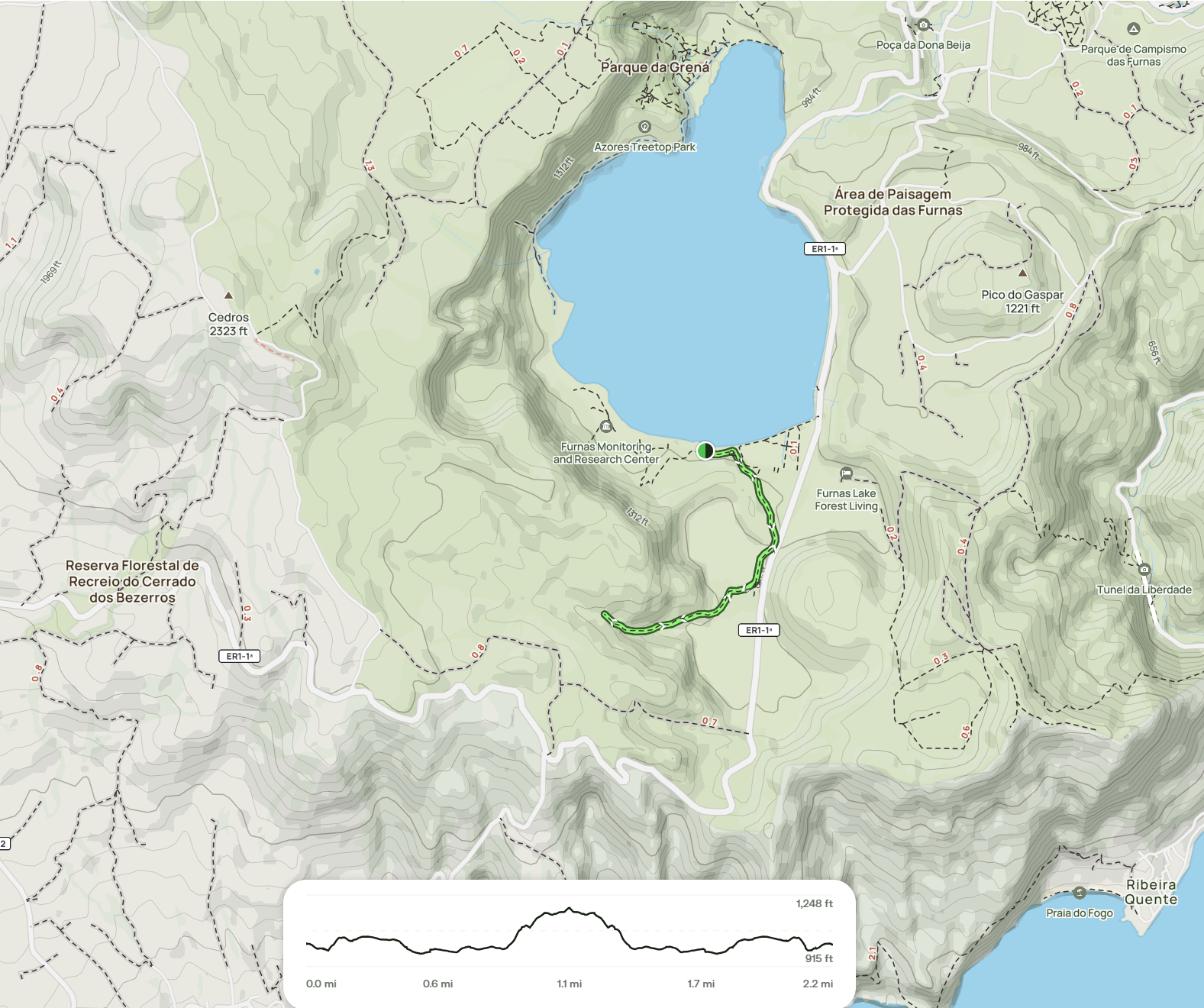
10) Lagoa das Furnas hike (PRC06 SMI)
Trail Information:
Category - Circular
Difficulty - Easy
Extension - 9.5 km
Time average - 3h00
This circular route in Furnas begins at the entrance of the village, near Largo das Três Bicas.

Follow the marks along the village, passing by Igreja de Santana and Poça da Dona Beija until you reach a crossroad where you should continue towards Pico do Milho. From the top of this elevation it is possible to profit the view over the valley of Furnas.
Proceed along the road until you arrive to Lagoa of Furnas and follow left, by the cobblestone road, going round the lake. Along this way you will cross the Chapel of Nossa Senhora das Vitórias, a gothic construction from the 19th century, the garden Mata Jardim José do Canto and by the house Casa dos Barcos (Rural Tourism). Further ahead you will find the Furnas Environmental Interpretation Centre and the surrounding area with several leisure places, ruins of ancient ovens of coal production and the biggest classified norfolk island pine (Araucaria heterophylla) in Europe.
Follow the road along the lake bank, through a very accessible flat dirt road where it is possible to see several wooden sculptures. Pass the crossing with the trail PRC 22 SMI – Grená/Pico do Ferro and continue until the area of Caldeiras. This place, due to the geothermal activity, provides one of the tourism advertisings of the island and where is done the famous traditional Cozido à Portuguesa, using the internal heat of the Furnas volcano.
After enjoying this scenery, continue passing by the crossroad to the viewpoint of Pico do Ferro (PRC 22 SMI – Grená/Pico do Ferro) and by the area of the ticket booth until reaching the regional road, where you should follow left. Proceed, carefully, along the road until you arrive the village center, place where the trail ends.

View along the Lagoa das Furnas trail
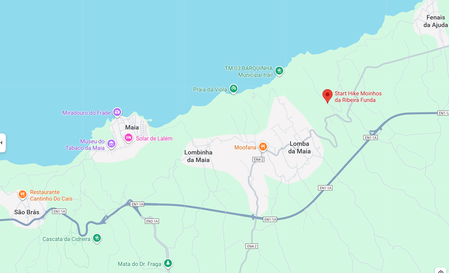
11) Moinhos da Ribeira Funda hike (PRC 35)
Trail type: circular
Duration: 2 hours
Difficulty: Medium
How to get there: find the trailhead at the Chapel of Nossa Senhora da Aflição
This is a fantastic hike that is not as visited. The trail offers a combination of forests and coastal landscapes.
The “mills of the low river” hike starts amid cornfields and quickly drops deep into a river valley with dense tree cover and yellow ginger lilies.
There, you pass by a creek with several ruined stone watermills, which make for nice spots for a break.
The second half leaves the forest behind and goes through a wide-open coastal landscape, offering panoramic views of São Miguel’s northern coastline.
A few km’s drive east of the trail you can also find the Zona Balnear da Foz das Coelhas, a secret little pool by a small wild beach.
To cap off your trip with a great meal, try Restaurante Poço Azul or go to the super local Cafe Tavares, for drinks and snacks with a view of the gently rolling fields along the coast. Saúde!
More Sao Miguel hikes to consider
If your stay is longer, here are a few additional hiking trails in São Miguel.
Janela do Inferno hike – An easy trail that includes tunnels, aqueducts, a jungle-like forest and the mysterious little waterfall known as Janela do Inferno or Window of Hell.
Salto da Farinha hike – A short but steep trail leading to a 40-meter-tall (131 ft) waterfall with a plunge pool where you can swim. Note that in the summer, the waterfall sometimes dries up.
Pico da Vara hike – A steep, moderate hike to the highest point on the island (1103 m/3619 ft). On a clear day, you can see a panoramic view of São Miguel at the summit.
Poço Azul hike – A short and easy hike to a natural pool with clear blue water surrounded by lush nature.
Things to know before hiking in the Azores
The best time to go hiking in the Azores is from June to September. July and August are the warmest and driest months of the year but also the busiest. With that said, I visited São Miguel in July and the only busy places were Grota do Inferno, Salto do Cabrito and Salto do Prego. On the rest of the trails we only saw a few other people.
June to September is also the time when hydrangeas are in bloom in the Azores. These gorgeous blue flowers line many roads and hiking trails in the Azores and make the already beautiful nature even more amazing!
It’s best to rent a car, as most trailheads are well away from any public transportation. The alternative is to use taxis, but this can get expensive if you plan to do a lot of hikes. Alternatively, you can take guided hiking tours that include pick-up, such as this guided trek in Sete Cidades and this tour that includes the Moinho do Felix hike.
The weather can be unpredictable, even in summer, so bring a rain jacket just in case. Sometimes the sun will be fully shining in one area, while a place just 20 minutes away is covered in mist..
Since the Azores Islands receive quite a lot of rain, trails tend to get muddy so choose appropriate footwear such as hiking boots or trainers that you don’t mind getting muddy.
The trailheads are usually very easy to find. All of the trails with official PR designations are well-indicated, generally well-maintained, and safe. However, it’s worth checking the official Azores website for trail information before you head out, in case a trail is temporarily closed. Many trails also are marked with yellow and red markers. Two parallel lines mean that you’re going in the right direction whereas two crossed lines (an X-shape) indicate the wrong way.
It’s not recommended to drink the water from the streams and rivers in the Azores, unless you have a water purifier bottle like the one from Grayl. Tap water, on the other hand, is perfectly safe to drink.
Hiking in Sao Miguel: Final thoughts
Hiking is one of the top things to do in São Miguel. The island’s green hills, calm lakes, and hidden waterfalls offer a beautiful place to enjoy nature. It’s a great way to relax and take a break from the stress of city-living.